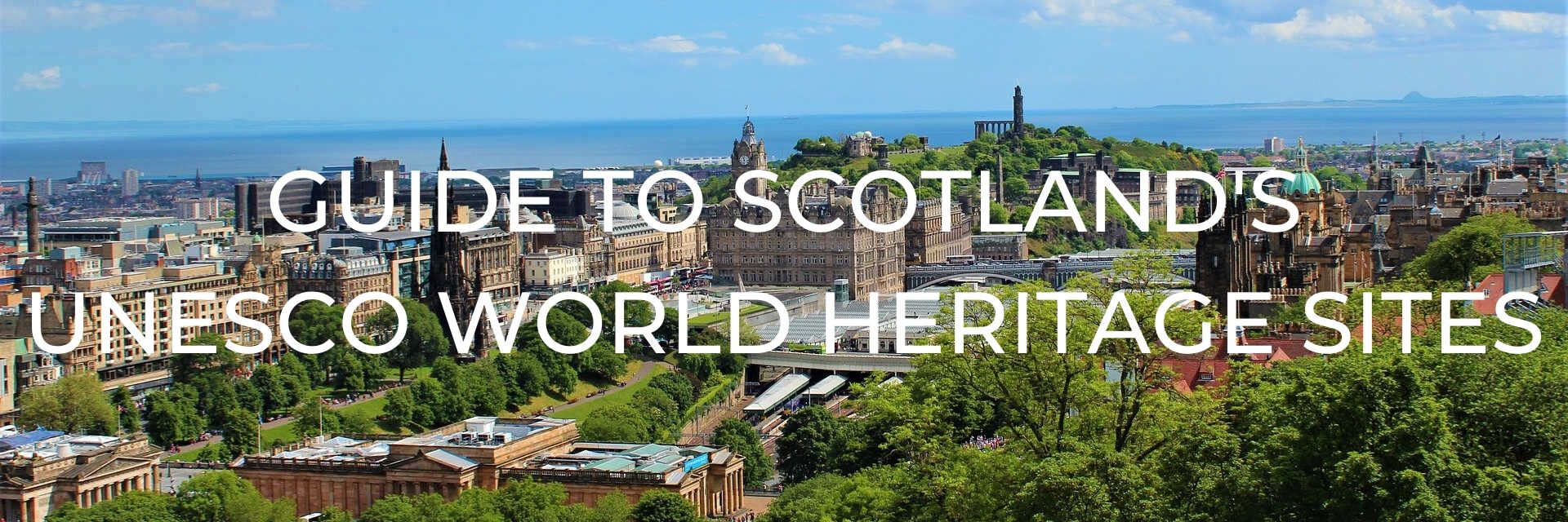
You may have heard people talk about UNESCO World Heritage sites or have visited them yourself but just what are they?
This post may contain affiliate links. Please read our full disclosure policy here.
World Heritage Sites are “A place (such as a forest, mountain, lake, desert, monument, building, complex, or city) that is listed by the UNESCO as of special cultural or physical significance. As of July 2019, 1121 sites are listed: 869 cultural, 213 natural, and 39 mixed properties. While each World Heritage Site remains part of the legal territory of the state wherein the site is located, UNESCO considers it in the interest of the international community to preserve each site.” To be included on the list a site must be of “outstanding universal value” and meet at least one out of ten selection criteria.
So if you’re feeling a bit lost about where to start planning your Scotland itinerary, then read on to learn more about their UNESCO World Heritage sites which should help give you some inspiration, especially if you are interested in culture, history, and beautiful scenery.
TABLE OF CONTENTS
SCOTLAND’S UNESCO WORLD HERITAGE SITES
Inscribed to World Heritage List: 1986; extended in 2004 and 2005
The beauty of St Kilda is hard to imagine, and it is one of the few World Heritage Sites to hold mixed status for its cultural and natural qualities. It was first inscribed to the list in 1986 because of its wildlife and “outstanding natural features”. It was then extended in 2004 to include the surrounding marine environment and again in 2005 as an outstanding example of how its population existed in such harsh terrain for over 2000 years.
St Kilda is a volcanic archipelago of four islands within the Hebrides, often called the “islands at the edge of the world” with their ragged cliff edges that plunge into the stormy Atlantic seas. The islands host the largest colony of seabirds in Europe which includes the UK’s largest colony of Atlantic puffins and a fifth of the world’s northern gannets.
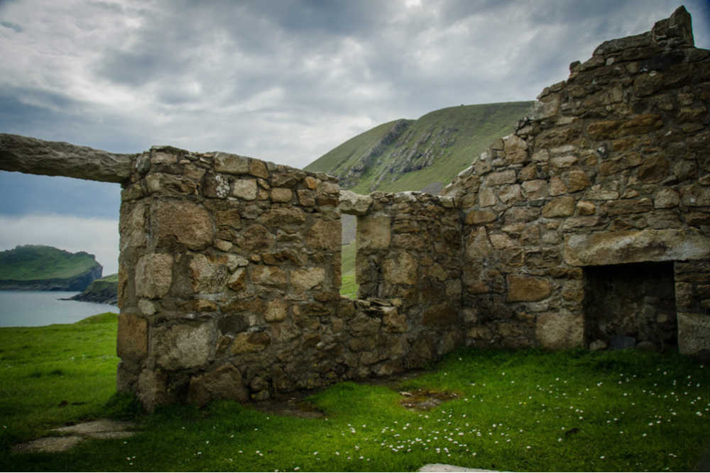
Photo Credit: Donna Green / CC BY 2.0
The landscape still bears traces of the age-old traditions of land use from the 4000 years of human habitation. The population probably never numbered more than about 180 but the numbers slowly dwindled to just 36 who were evacuated at their own request in 1930 because they couldn’t sustain their way of life any longer. The people had survived a very harsh environment by catching seabirds for food, feathers, and oil, farming crops, and raising livestock.
Today 16 houses remain of the original 25-30 houses. These were made of dry stone and covered with turf, typically with just one small window and an opening to let out the smoke from the peat fire that burnt in the middle of the room. There was straw laid on the floor and cattle would have lived in one end of the house in the winter. There are also “cleits”, that were used for storage, which are small drystone constructions with stone slabs for a roof that is then covered with earth and turf.
LOCATION:
St Kilda is one of the most remote parts of the British Isles situated in the Atlantic Ocean about 40 miles (66 km) west of North Uist in Scotland’s Outer Hebrides.
VISITING ST KILDA:
During the summer visitors to St Kilda can see some of the busiest seabird colonies in Europe and may also see whales or basking sharks in the surrounding waters. In Village Bay, there are wild sheep grazing in the abandoned village and you can take a self-guided walk to visit the old “main street”, the ‘House of Fairies’, graveyard, and the turf-roofed huts. There is also a museum where you can view a small collection of artefacts left behind by the inhabitants.
St Kilda is the most challenging to reach of all of Scotland’s UNESCO sites. There are charter boats that run from Mallaig and Oban on the Scottish Mainland which take about 18 hours to get to St Kilda. Alternatively, there are also boats from the Western Isles, such as the Isle of Harris, which take about 2-4 hours to get to the island. Two companies that offer these tours are Kilda Cruises and Sea Harris, both of which leave from Leverburgh.
In addition to privately run boat tours and cruises, you can also go by applying for a place on one of the St Kilda Conservation Work Parties. There are accommodations on the island for visitors in a small campsite which takes a maximum of six people and must be booked in advance.
HELPFUL LINKS:
- The National Trust for Scotland for St Kilda website
- UNESCO World Heritage List Entry
- Information about St Kilda Conservation Work Parties
- More photos can be found at Our Place – The World Heritage Collection
- A complete guide to planning your trip to St Kilda from Kathi of Watch Me See
Inscribed to World Heritage List: 2008
The Antonine Wall is part of the transnational heritage site “Frontiers of the Roman Empire” which includes the other Roman frontier fortifications Hadrian’s Wall (UK) and the German Limes (Germany). It was added to the World Heritage list because it demonstrates the survival of the 2nd-century Roman frontier system across Europe, North Africa, and the Middle East which reflects the development and breadth of Roman military architecture and power.
Construction of the wall was ordered by the Roman Emperor, Antoninus Pius, around AD 142. About 7,000 men built this last linear frontier that was only occupied for about a generation before it was abandoned in AD 160. The wall ran for about 60 km across central Scotland from modern Bo’ness on the Firth of Forth to Old Kilpatrick on the River Clyde.
The wall originally stood about four metres (13 ft) high and was made of turf blocks resting on a stone foundation that was fronted by a wide and deep ditch. It may have also been topped with a palisade of sharpened wooden pikes.
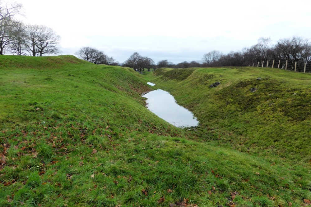
Along the south side, there was a cobbled road, called ‘Military Way’, that was used for transporting materials. This road linked a network of forts and fortlets that housed the troops stationed at the frontier and acted as secure crossing points to control movement north and south.
A unique feature of the Antonine Wall is the beautifully decorated distance slabs that were carved by the soldiers as they finished each section. There are 19 known slabs (17 of which are in the Hunterian Museum in Glasgow) which all feature written inscriptions of the title of the legion of soldiers that built the section, the name of the emperor, and the length of the section constructed.
LOCATION:
The Antonine Wall runs across central Scotland from Old Kilpatrick in the west to Bo’ness in the east across five modern localities – East Dunbartonshire, Falkirk, Glasgow, North Lanarkshire, and West Dunbartonshire.
VISITING THE ANTONINE WALL:
Unfortunately, most of the turf has weathered away, been destroyed over time, or lost in farmland or beneath towns and other settlements, but there are still sections of the wall that can be visited.
Some of the best-preserved sections of the ramparts, ditch and Military Way are Croy Hill, Seabegs, or Rough Castle. There are Roman Baths at Bearsden and Bar Hill.
There are also a number of sites and museums in each of the communities that the wall passes through such as; Kinneil Fortlet and Museum, Polmontill, Callendar Park and Museum in Falkirk, Watling Lodge in Tamfourhill, and Castlehill Fort.
We visited the Rough Castle section of the wall. Here there was a small parking lot and we were able to get out and wander around the area. There were information signs along the way to help with points of interest and historical facts. It was a very peaceful outdoor space with several others out exploring the site or walking their dogs.
- The Official Antonine Wall Website
- UNESCO World Heritage List Entry
Inscribed to World Heritage List: 2001
Founded in 1785 by the industrial entrepreneur David Dale, New Lanark is a restored 18th-century cotton mill village in the narrow gorge of the River Clyde. It was inscribed to the World Heritage list because of its significant role in the development of model industrial settlements.
Soon after Dale founded the village, he was joined by fellow philanthropist Robert Owen and between them, their reforms proved that commercial success did not undermine the wellbeing of the workforce. By 1799, New Lanark was the biggest cotton mill in Scotland with about 2,000 people who lived and/or worked in the village.
Robert Owen took over the mill as sole owner by 1800 and made significant changes to some of the previous practices, such as not employing children under the age of 10 and reducing working hours for them from 13 to 10 hours per day. He also built schools for all the children and offered evening classes to help educate his adult workforce. He abolished physical punishment in the factory and schools, and the villagers had access to free medical care, a sickness fund, savings bank, and a village store with affordable food and household goods. He was a true pioneer for his time!
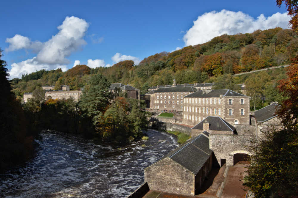
Photo Credit: Magnus Hagdorn / CC BY-SA 2.0
The sandstone cotton mills were built in a dramatic gorge in Lanarkshire which was ideal as they could be powered by the Falls of Clyde. The village became of a place of pilgrimage for social reformers, statesmen, and even royalty and manufactured cotton until 1968.
Today the buildings look much as they did in the early 19th-century and New Lanark remains a thriving community with a resident population, visitor centre, hotel, and a range of small businesses. The village is also a gateway to the Falls of Clyde Wildlife Reserve which is home to over 100 species of birds. There are also woodland walks that take you to views of the waterfalls and gorge that are so pretty they inspired paintings by Turner, poems by Wordsworth, and the writing of Sir Walter Scott.
LOCATION:
New Lanark is located by the falls of the River Clyde in southern central Scotland near the market town of Lanark.
It is less than an hour’s drive from both Edinburgh and Glasgow, or there are trains that run from Glasgow Central station, so it would be a great day trip from either city.
VISITING NEW LANARK:
Visitors will get a great sense of how life would have been for the bustling community of workers and their families in the early 19th century as they walk around the narrow valley with the sound of rushing water never far off.
The village includes the mill, a museum, the village store, a 1700s school classroom, an Engine House with a restored Petrie steam engine, the Millworkers’ Houses which are two recreated tenements from the 1820s and 1930s to see how people lived, and Robert Owen’s house.
A more modern attraction is the New Millennium Experience which is a special-effects ride through time from the life of a mill girl in 1820 to the 23rd century.
If you would like to spend a night or two at a UNESCO World Heritage site then you are in luck! The New Lanark Mill Hotel was once an 18th-century cotton mill that has been restored and converted into a modern hotel with 38 rooms that retain the original Georgian windows and barrel-vaulted ceilings. Another option is the self-catering Waterhouses that overlook the River Clyde of which five of the eight cottages have been specially adapted for wheelchair users.
HELPFUL LINKS:
Inscribed to World Heritage List: 1999
Built about 5,000 years ago, the Heart of Neolithic Orkney was inscribed to the World Heritage list for its value as “the outstanding testimony the monuments bear to the cultural achievements of the Neolithic peoples of northern Europe.”
Made up of several monuments such as Skara Brae, Maes Howe, the Stones of Stenness, and the Ring of Brodgar, these domestic and ritual monuments are masterpieces of Neolithic design and construction and give us insights into the society, skills, and spiritual beliefs of the people who built them.
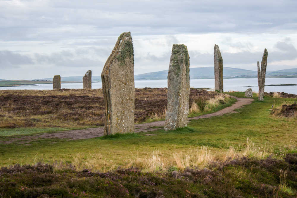
Photo Credit: Shadowgate / CC BY 2.0
Much of the site hasn’t been fully excavated and may yet reveal more information. Sites that have been excavated and can be visited are:
- Skara Brae: This complete Stone Age village was unearthed by a storm in 1850, after lying buried for 4,500 years. It offers a view into the lives of the people who lived there with its stone walls, passageways, and stone furnishings that survive to the present day.
- Maes Howe: Dating from 2,000 BC, this is one of the largest tombs in Orkney and is estimated to be made with 30 tons of sandstone and to have taken 100,000 man-hours to construct. This chambered tomb was designed so that the light of the setting sun at the winter solstice focuses on the narrow passageway and illuminates the chamber inside, much the same as the chambered tomb of Newgrange in Ireland.
- Stones of Stenness: This monument was made of 12 thin slabs of standing stones erected around 3,000 BC in the form of an ellipse enclosed by a ditch. Today only four stones remain but their height (6 metres), extraordinary thinness, and position make this an inspiring site. Some hypothesize that the stones may have been associated with rituals at Maes Howe.
- Ring of Brodgar: This is likely one of the last of the great Neolithic structures built here with an estimated creation date of between 2,500 and 1,500 BC. The site is a large ceremonial enclosure about 130 metres across that is situated on high ground in the centre of a huge ‘cauldron’ formed by the surrounding hills. There is no firm evidence of their purpose, but it is believed it was made to observe, record, and possibly celebrate solar and lunar events.
LOCATION:
The Orkney Islands are located about 15 km (9 miles) off the icy, wind-blasted coast of northern mainland Scotland.
There are 40 islands and islets that make up the archipelago, of which only 17 are inhabited. The two areas which make up the UNESCO World Heritage site are on the largest island.
VISITING NEOLITHIC ORKNEY:
Although the Orkney Islands are geographically isolated there are good transport links within the islands themselves and connecting them to cities on the Scottish mainland such as Aberdeen, Inverness, Edinburgh, and Glasgow.
Both Northlink and Pentland offer ferry service and you can take a train from Aberdeen to connect with the Northlink ferry.
You can visit all of the monuments that make up the Heart of Neolithic Orkney site. Specifically, at the Ring of Brodgar, rangers lead walks on selected dates from March to September around the ring to explore the iconic monument and its surrounding landscape.
HELPFUL LINKS:
- Historic Environment Scotland
- UNESCO World Heritage List Entry
- More photos can be found at Our Place – The World Heritage Collection
Inscribed to World Heritage List: 2015
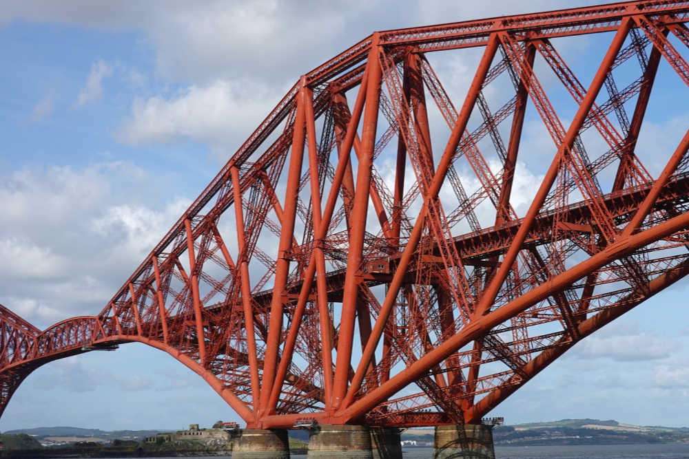
The Forth Bridge is considered a symbol of Scotland and was voted Scotland’s greatest man-made wonder in 2016. It was also inscribed to the UNESCO World Heritage list in 2015 for its value as” a masterpiece of human creative genius and an aesthetic triumph in its achievement of tremendous grace, despite its solid construction and lack of any decoration.”
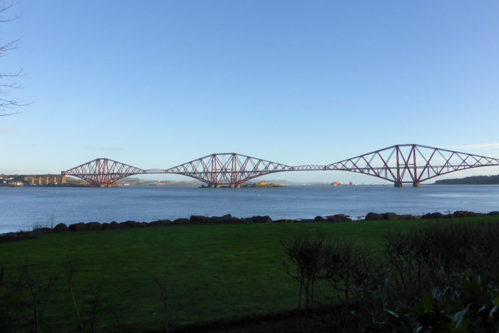
Built between 1882 and 1890, the Forth Bridge is about nine miles west of Edinburgh city centre and spans the Firth of Forth. When it was constructed it was the world’s longest cantilever bridge spanning 2,529 metres and it held this title for 27 years. It still remains one of the greatest cantilever trussed bridges in the world and is a major rail crossing that still carries more than 200 trains a day.
It was the world’s first major steel structure and is considered one of the greatest engineering achievements of the late Victorian era. The massive cantilevered sections are held together with more than 6.5 million rivets and the paint area adds up to about 55 ha (135 acres). With such an area to paint, once they were finished painting it was time to start at the beginning again which prompted the saying “It’s like painting the Forth Bridge” which has become a saying meaning something that never ends!
LOCATION:
The Forth Bridge is located in central Scotland where it crosses the Forth River estuary between North Queensferry in Fife and Queensferry in the Lothians.
VISITING THE FORTH BRIDGE:
The only access to the bridge itself is to take the train across, which is what we did on our visit. We recommend taking the time to do this as you actually get to “use” a UNESCO site for its intended purpose instead of merely something you see or something that has been preserved as a museum. We caught the train at Dalmeny Station and took it across the bridge to North Queensferry Station and then made the return trip back to Dalmeny Station where we’d parked our car. If you opt to do the same, be sure to check out the great mosaic mural at the North Queensferry station while you’re waiting for your train back.
To view the bridge only, you can visit both North and South Queensferry, with the best views from the South Queensferry promenade. You can also drive a car, or take a bus, across the Forth Road Bridge for views of the Forth Bridge, or you can take a river cruise to get views from under the bridge all while enjoying a cream tea!
HELPFUL LINKS:
- Official Website for the Forth Bridges
- UNESCO World Heritage List Entry
- Consider these cruise options to view the Forth Bridge:
Inscribed to World Heritage List: 1995
Edinburgh has been the capital of Scotland since the 15th century and is renowned for its writers, artists, philosophers, and scientists.
The two areas of the city, the Old and New Towns, each have distinctive and important buildings which together form a city with unique character. It is the value of these two areas of the city that “dramatically reflects significant changes in European urban planning” that earned the city a spot on the UNESCO World Heritage list.
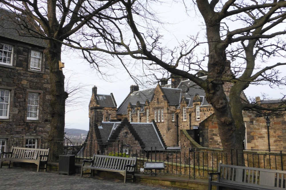
The city was built on a landscape of hills and valleys that was formed millions of years ago by volcanoes and ice sheets. It is a city with many moods and a long and venerable history that makes it a delight to visit.
The Old Town straddles the ridge between Edinburgh Castle and the Palace of Holyroodhouse with most of the city’s medieval history found in the alleys of the Grassmarket and Royal Mile areas. Here you’ll find narrow passageways, called closes and wynds, and many of the city’s key sights like the castle, Palace of Holyroodhouse and St. Giles Cathedral that are all a pleasure to visit and explore.
The New Town evolved in the 18th century when wealthy merchants expanded the city beyond its medieval walls. This area now contains the best concentration of Georgian architecture in Britain.
LOCATION:
Edinburgh is located in southeast Scotland on the south shore of the Firth of Forth. The city was originally founded on, and around, Castle Rock and today it spans seven hills including Arthur’s Seat and Calton Hill.
It is well served by road, sea, train, and air from destinations within the UK and from other countries. Click here for detailed information about getting to Edinburgh.
VISITING EDINBURGH:
There are so many great attractions in Edinburgh you could easily spend a weekend, or even a week, in the city and not run out of things to see and do.
The compact city is best seen on foot and is divided into two main sightseeing areas by Princes Street, which is the city’s most famous thoroughfare and commercial centre.
Some of the highlights and must-see places in Edinburgh are:
- Edinburgh Castle is the crown of the Old Town and overlooks the New Town.
- Gladstone’s Land for a look inside 17th-century merchant’s apartment in the Old Town.
- Calton Hill for panoramic views across the city.
- The Royal Mile is lined with historical buildings, little tucked away alleys and closes, and restaurants and cafes for a taste of the city.
HELPFUL LINKS:
- Official Guide to Edinburgh
- UNESCO World Heritage List Entry
- More photos can be found at Our Place – The World Heritage Collection
- Weekend Guide to Edinburgh
Looking for more information to plan your visit to Scotland? You may find these articles helpful.
RESOURCES | PLAN YOUR TRIP TO SCOTLAND
To book flights, rental cars, accommodations, and activities for your trip, please check out our recommended travel providers, favourite apps and websites.
- World Heritage Sites of Great Britain and Ireland: An Illustrated Guide to all 27 World Heritage Sites (there are actually more than 27 sites now but this is still a great book)
- World Heritage Sites: A Complete Guide to 1,073 UNESCO World Heritage Sites
- For all things Scotland, you can’t go wrong with Rick Steves! Check out his Scotland travel guide, full episodes of his TV show, or download his app for excellent audio tours.
- Looking for more great UNESCO sites to visit in the UK? Check out these eight great UNESCO sites to visit from London!
Some of the links in the post above are affiliate links. This means if you click on the link and purchase the item, we will receive an affiliate commission but this does not affect the price to you. Please read our full disclosure policy here.


